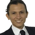
J*****o
Información del candidato
Julio César Sánchez Sarmiento is a surveying and environmental engineering proficient in ArcGIS
Pro, AutoCAD, QGIS, and Civil CAD. He has conducted drone flights for lagoon point surveys and
bathymetry, levels total stations in under four minutes, and supported CAR bird surveys. His
environmental experience includes social projects using a small-scale PTAR prototype to treat
Bogotá River water for plant irrigation whit CERUS.
Educación
A professional trained in the development and implementation of strategies, programmes and projects that contribute to the prevention and mitigation of environmental impacts, with the aim of improving quality of life within the framework of sustainable development.
A professional capable of accurately surveying, mapping and representing the land using advanced technologies for infrastructure, town planning and land registry projects.
Experiencia laboral
Analyses round of people whit construction and distribution of water at of community + small prototype of purification of water, for extraction at water of Bogotá River (e.g., Implemented a new sales strategy that increased revenue by 20% in 6 months).